Kasabonika Lake Topo Map Online
Download Free Topo Map Sheet 053H10 at 1:50,000 scale
053H10 Kasabonika Lake Topo Map
To view this map, mouse over the map preview on the right.
You can also download this topo map for free:
053H10 Kasabonika Lake high-resolution topo map image.
Maps for the Kasabonika Lake topo map sheet 053H10 at 1:50,000 scale are also available in these versions:
Kasabonika Lake Surrounding Area Topo Maps
 |
 |
 |
 |
 |
 |
 |
 |
 |
 |
 |
 |
 |
 |
 |
 |
© Department of Natural Resources Canada. All rights reserved.
Kasabonika Lake Gazetteer
The following places can be found on topographic map sheet 053H10 Kasabonika Lake:
Kasabonika Lake Topo Map: Indian Reserves
Kasabonika LakeKasabonika Lake Indian Reserve
Réserve indienne Kasabonika Lake
Kasabonika Lake Topo Map: Islands
Kasabonika IslandKasabonika Lake Topo Map: Lakes
Kasabonika LakeKasabonika Lake Topo Map: Rivers
Asheweig RiverKasabonika Lake Topo Map: Unincorporated areas
Kasabonika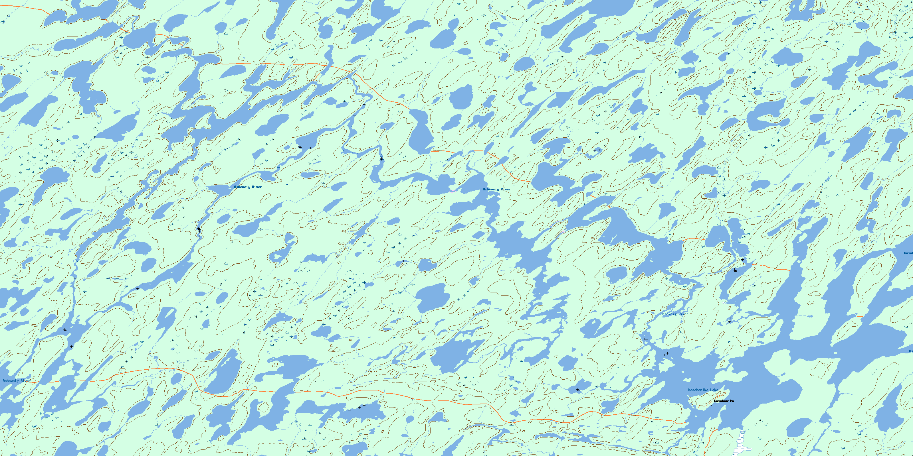
© Department of Natural Resources Canada. All rights reserved.
053H Related Maps:
053H Asheweig River053H01 Wapikopa River
053H02 Reeb Lake
053H03 Big North Lake
053H04 Kingfisher Lake
053H05 Kaneesose Lake
053H06 Long Dog Lake
053H07 No Title
053H08 No Title
053H09 Shibogama Lake
053H10 Kasabonika Lake
053H11 No Title
053H12 Nemeigusabins Lake
053H13 Sandybank Lake
053H14 Otter River
053H15 Frog River
053H16 No Title
