Falstaff Island Topo Map Online
Download Free Topo Map Sheet 055J13 at 1:50,000 scale
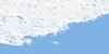
055J13 Falstaff Island Topo Map
To view this map, mouse over the map preview on the right.
You can also download this topo map for free:
055J13 Falstaff Island high-resolution topo map image.
Maps for the Falstaff Island topo map sheet 055J13 at 1:50,000 scale are also available in these versions:
Falstaff Island Surrounding Area Topo Maps
 |
 |
 |
|
 |
 |
||
© Department of Natural Resources Canada. All rights reserved.
Falstaff Island Gazetteer
The following places can be found on topographic map sheet 055J13 Falstaff Island:
Falstaff Island Topo Map: Bays
Dry CoveHorseshoe Deep
Rankin Inlet
Falstaff Island Topo Map: Capes
Dark PointSiskin Point
Falstaff Island Topo Map: Channels
Thomson PassageFalstaff Island Topo Map: Islands
Falstaff IslandGravel Islets
Guillemot Island
Mannik Islet
Penny Islet
Thomson Island
Falstaff Island Topo Map: Mountains
False KnollTwin Knolls
Falstaff Island Topo Map: Shoals
Guillemot BankHarp Rock
Kelp Rock

© Department of Natural Resources Canada. All rights reserved.
