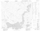
Maps showing Anchor Point, Newfoundland and Labrador
Anchor Point is a Cape located in Newfoundland and Labrador and has an elevation of 22 meters.
- Latitude: 56° 53' 39'' North (decimal: 56.8941398)
- Longitude: 61° 37' 14'' West (decimal: -61.6204716)
- Topography Feature Category: Cape
- Geographical Feature: Point
- Canadian Province/Territory: Newfoundland and Labrador
- Elevation: 22 meters
- Atlas of Canada Locator Map: Anchor Point
- GPS Coordinate Locator Map: Anchor Point Lat/Long
Anchor Point NTS Map Sheets