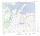
Maps showing Avakutak River, Newfoundland and Labrador
Avakutak River is a River located in Newfoundland and Labrador and has an elevation of 1 meters.
- Latitude: 57° 10' 59'' North (decimal: 57.1831049)
- Longitude: 61° 52' 29'' West (decimal: -61.8746913)
- Topography Feature Category: River
- Geographical Feature: River
- Canadian Province/Territory: Newfoundland and Labrador
- Elevation: 1 meters
- Atlas of Canada Locator Map: Avakutak River
- GPS Coordinate Locator Map: Avakutak River Lat/Long