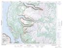
Maps showing Bear Cove, St. Barbe South, Newfoundland and Labrador
Bear Cove is a Unincorporated area located in St. Barbe South, Newfoundland and Labrador and has an elevation of 36 meters.
- Latitude: 49° 36' 2'' North (decimal: 49.6005555)
- Longitude: 57° 55' 38'' West (decimal: -57.9272222)
- Topography Feature Category: Unincorporated area
- Geographical Feature: Neighbourhood
- Canadian Province/Territory: Newfoundland and Labrador
- Elevation: 36 meters
- Location: St. Barbe South
- Atlas of Canada Locator Map: Bear Cove
- GPS Coordinate Locator Map: Bear Cove Lat/Long
Bear Cove NTS Map Sheets