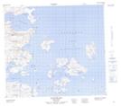
Maps showing Big Black Island, Newfoundland and Labrador
Big Black Island is a Island located in Newfoundland and Labrador and has an elevation of 14 meters.
- Latitude: 56° 47' 15'' North (decimal: 56.7875878)
- Longitude: 61° 20' 21'' West (decimal: -61.3392030)
- Topography Feature Category: Island
- Geographical Feature: Island
- Canadian Province/Territory: Newfoundland and Labrador
- Elevation: 14 meters
- Atlas of Canada Locator Map: Big Black Island
- GPS Coordinate Locator Map: Big Black Island Lat/Long