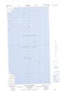
Maps showing Big Rookery Island, Newfoundland and Labrador
Big Rookery Island is a Island located in Newfoundland and Labrador and has an elevation of 7 meters.
- Latitude: 57° 28' 45'' North (decimal: 57.4792460)
- Longitude: 61° 24' 33'' West (decimal: -61.4092562)
- Topography Feature Category: Island
- Geographical Feature: Island
- Canadian Province/Territory: Newfoundland and Labrador
- Elevation: 7 meters
- Atlas of Canada Locator Map: Big Rookery Island
- GPS Coordinate Locator Map: Big Rookery Island Lat/Long