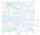
Maps showing Challenger Knoll, Newfoundland and Labrador
Challenger Knoll is a Shoal located in Newfoundland and Labrador and has an elevation of 73 meters.
- Latitude: 56° 44' 14'' North (decimal: 56.7373377)
- Longitude: 61° 38' 54'' West (decimal: -61.6482464)
- Topography Feature Category: Shoal
- Geographical Feature: Knoll
- Canadian Province/Territory: Newfoundland and Labrador
- Elevation: 73 meters
- Atlas of Canada Locator Map: Challenger Knoll
- GPS Coordinate Locator Map: Challenger Knoll Lat/Long