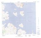
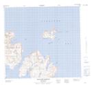
Maps showing Clarke Inlet, Newfoundland and Labrador
Clarke Inlet is a Bay located in Newfoundland and Labrador and has an elevation of 165 meters.
- Latitude: 57° 44' 48'' North (decimal: 57.7465512)
- Longitude: 61° 41' 14'' West (decimal: -61.6870902)
- Topography Feature Category: Bay
- Geographical Feature: Inlet
- Canadian Province/Territory: Newfoundland and Labrador
- Elevation: 165 meters
- Atlas of Canada Locator Map: Clarke Inlet
- GPS Coordinate Locator Map: Clarke Inlet Lat/Long
Clarke Inlet NTS Map Sheets