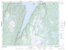
Maps showing Clay Cove, Newfoundland and Labrador
Clay Cove is a Bay located in Newfoundland and Labrador and has an elevation of 35 meters.
- Latitude: 49° 43' 48'' North (decimal: 49.7300000)
- Longitude: 56° 41' 21'' West (decimal: -56.6891666)
- Topography Feature Category: Bay
- Geographical Feature: Cove
- Canadian Province/Territory: Newfoundland and Labrador
- Elevation: 35 meters
- Atlas of Canada Locator Map: Clay Cove
- GPS Coordinate Locator Map: Clay Cove Lat/Long