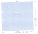
Maps showing The Clusters Harbour, Newfoundland and Labrador
The Clusters Harbour is a Bay located in Newfoundland and Labrador and has an elevation of 0 meters.
- Latitude: 56° 27' 37'' North (decimal: 56.4602585)
- Longitude: 60° 56' 1'' West (decimal: -60.9336437)
- Topography Feature Category: Bay
- Geographical Feature: Harbour
- Canadian Province/Territory: Newfoundland and Labrador
- Elevation: 0 meters
- Atlas of Canada Locator Map: The Clusters Harbour
- GPS Coordinate Locator Map: The Clusters Harbour Lat/Long
The Clusters Harbour NTS Map Sheets