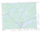
Maps showing Cook's Pond, Newfoundland and Labrador
Cook's Pond is a Lake located in Newfoundland and Labrador and has an elevation of 109 meters.
- Latitude: 48° 57' 32'' North (decimal: 48.9588888)
- Longitude: 54° 9' 9'' West (decimal: -54.1525000)
- Topography Feature Category: Lake
- Geographical Feature: Pond
- Canadian Province/Territory: Newfoundland and Labrador
- Elevation: 109 meters
- Atlas of Canada Locator Map: Cook's Pond
- GPS Coordinate Locator Map: Cook's Pond Lat/Long