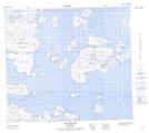
Maps showing Dog (High) Island, Newfoundland and Labrador
Dog (High) Island is a Island located in Newfoundland and Labrador.
- Latitude: 56° 38' 00'' North (decimal: 56.6333333)
- Longitude: 61° 9' 57'' West (decimal: -61.1658333)
- Topography Feature Category: Island
- Geographical Feature: Island
- Canadian Province/Territory: Newfoundland and Labrador
- GPS Coordinate Locator Map: Dog (High) Island Lat/Long