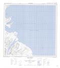
Maps showing Dry Reef, Newfoundland and Labrador
Dry Reef is a Shoal located in Newfoundland and Labrador.
- Latitude: 59° 43' 50'' North (decimal: 59.7305085)
- Longitude: 63° 43' 35'' West (decimal: -63.7264699)
- Topography Feature Category: Shoal
- Geographical Feature: Reef
- Canadian Province/Territory: Newfoundland and Labrador
- Atlas of Canada Locator Map: Dry Reef
- GPS Coordinate Locator Map: Dry Reef Lat/Long
Dry Reef NTS Map Sheets