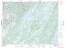
Maps showing East Branch, Newfoundland and Labrador
East Branch is a River located in Newfoundland and Labrador and has an elevation of 90 meters.
- Latitude: 49° 21' 00'' North (decimal: 49.3499999)
- Longitude: 57° 16' 26'' West (decimal: -57.2738888)
- Topography Feature Category: River
- Geographical Feature: Branch
- Canadian Province/Territory: Newfoundland and Labrador
- Elevation: 90 meters
- Atlas of Canada Locator Map: East Branch
- GPS Coordinate Locator Map: East Branch Lat/Long