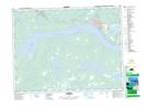
Maps showing Fifteen Mile Brook, Newfoundland and Labrador
Fifteen Mile Brook is a River located in Newfoundland and Labrador and has an elevation of 158 meters.
- Latitude: 48° 53' 47'' North (decimal: 48.8963888)
- Longitude: 54° 36' 22'' West (decimal: -54.6061111)
- Topography Feature Category: River
- Geographical Feature: Brook
- Canadian Province/Territory: Newfoundland and Labrador
- Elevation: 158 meters
- Atlas of Canada Locator Map: Fifteen Mile Brook
- GPS Coordinate Locator Map: Fifteen Mile Brook Lat/Long