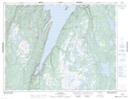
Maps showing Green Hill, Newfoundland and Labrador
Green Hill is a Mountain located in Newfoundland and Labrador and has an elevation of 64 meters.
- Latitude: 49° 32' 13'' North (decimal: 49.5369444)
- Longitude: 56° 51' 49'' West (decimal: -56.8636111)
- Topography Feature Category: Mountain
- Geographical Feature: Hill
- Canadian Province/Territory: Newfoundland and Labrador
- Elevation: 64 meters
- Atlas of Canada Locator Map: Green Hill
- GPS Coordinate Locator Map: Green Hill Lat/Long