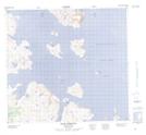
Maps showing Green Island Harbour, Newfoundland and Labrador
Green Island Harbour is a Bay located in Newfoundland and Labrador and has an elevation of 5 meters.
- Latitude: 57° 40' 9'' North (decimal: 57.6690323)
- Longitude: 61° 48' 32'' West (decimal: -61.8088617)
- Topography Feature Category: Bay
- Geographical Feature: Harbour
- Canadian Province/Territory: Newfoundland and Labrador
- Elevation: 5 meters
- Atlas of Canada Locator Map: Green Island Harbour
- GPS Coordinate Locator Map: Green Island Harbour Lat/Long