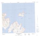
Maps showing Handle of the Sug, Newfoundland and Labrador
Handle of the Sug is a Cape located in Newfoundland and Labrador.
- Latitude: 57° 49' 00'' North (decimal: 57.8166666)
- Longitude: 61° 47' 56'' West (decimal: -61.7988888)
- Topography Feature Category: Cape
- Geographical Feature: Point
- Canadian Province/Territory: Newfoundland and Labrador
- Atlas of Canada Locator Map: Handle of the Sug
- GPS Coordinate Locator Map: Handle of the Sug Lat/Long
Handle of the Sug NTS Map Sheets