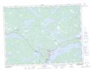
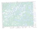
Maps showing Home Pond, Newfoundland and Labrador
Home Pond is a Lake located in Newfoundland and Labrador and has an elevation of 45 meters.
- Latitude: 48° 58' 34'' North (decimal: 48.9761111)
- Longitude: 54° 18' 15'' West (decimal: -54.3041666)
- Topography Feature Category: Lake
- Geographical Feature: Pond
- Canadian Province/Territory: Newfoundland and Labrador
- Elevation: 45 meters
- Atlas of Canada Locator Map: Home Pond
- GPS Coordinate Locator Map: Home Pond Lat/Long
Home Pond NTS Map Sheets