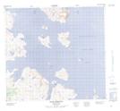
Maps showing Ingikanikuluk Point, Newfoundland and Labrador
Ingikanikuluk Point is a Cape located in Newfoundland and Labrador.
- Latitude: 57° 32' 25'' North (decimal: 57.5402243)
- Longitude: 61° 42' 34'' West (decimal: -61.7094659)
- Topography Feature Category: Cape
- Geographical Feature: Point
- Canadian Province/Territory: Newfoundland and Labrador
- Atlas of Canada Locator Map: Ingikanikuluk Point
- GPS Coordinate Locator Map: Ingikanikuluk Point Lat/Long