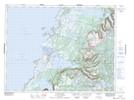
Maps showing Inside Bottom Pond, Newfoundland and Labrador
Inside Bottom Pond is a Lake located in Newfoundland and Labrador.
- Latitude: 49° 47' 30'' North (decimal: 49.7916666)
- Longitude: 57° 35' 37'' West (decimal: -57.5936111)
- Topography Feature Category: Lake
- Geographical Feature: Pond
- Canadian Province/Territory: Newfoundland and Labrador
- GPS Coordinate Locator Map: Inside Bottom Pond Lat/Long
Inside Bottom Pond NTS Map Sheets