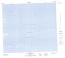
Maps showing Iota Islet, Newfoundland and Labrador
Iota Islet is a Island located in Newfoundland and Labrador.
- Latitude: 56° 25' 1'' North (decimal: 56.4170567)
- Longitude: 60° 37' 1'' West (decimal: -60.6168600)
- Topography Feature Category: Island
- Geographical Feature: Islet
- Canadian Province/Territory: Newfoundland and Labrador
- Atlas of Canada Locator Map: Iota Islet
- GPS Coordinate Locator Map: Iota Islet Lat/Long
Iota Islet NTS Map Sheets