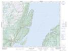
Maps showing Jackson's Arm, Humber Valley, Newfoundland and Labrador
Jackson's Arm is a Town located in Humber Valley, Newfoundland and Labrador and has an elevation of 34 meters.
- Latitude: 49° 51' 55'' North (decimal: 49.8652222)
- Longitude: 56° 48' 17'' West (decimal: -56.8048305)
- Topography Feature Category: Town
- Geographical Feature: Town
- Canadian Province/Territory: Newfoundland and Labrador
- Elevation: 34 meters
- Location: Humber Valley
- Atlas of Canada Locator Map: Jackson's Arm
- GPS Coordinate Locator Map: Jackson's Arm Lat/Long
Jackson's Arm NTS Map Sheets