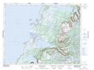
Maps showing Jim Vincent Pond, Newfoundland and Labrador
Jim Vincent Pond is a Lake located in Newfoundland and Labrador.
- Latitude: 49° 54' 55'' North (decimal: 49.9152777)
- Longitude: 57° 38' 17'' West (decimal: -57.6380555)
- Topography Feature Category: Lake
- Geographical Feature: Pond
- Canadian Province/Territory: Newfoundland and Labrador
- GPS Coordinate Locator Map: Jim Vincent Pond Lat/Long
Jim Vincent Pond NTS Map Sheets