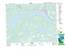
Maps showing Joe Batts Pond, Newfoundland and Labrador
Joe Batts Pond is a Lake located in Newfoundland and Labrador and has an elevation of 58 meters.
- Latitude: 48° 58' 43'' North (decimal: 48.9786111)
- Longitude: 54° 45' 24'' West (decimal: -54.7566666)
- Topography Feature Category: Lake
- Geographical Feature: Pond
- Canadian Province/Territory: Newfoundland and Labrador
- Elevation: 58 meters
- Atlas of Canada Locator Map: Joe Batts Pond
- GPS Coordinate Locator Map: Joe Batts Pond Lat/Long