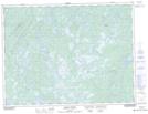
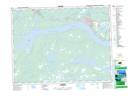
Maps showing Joe's Feeder, Newfoundland and Labrador
Joe's Feeder is a River located in Newfoundland and Labrador and has an elevation of 118 meters.
- Latitude: 48° 51' 49'' North (decimal: 48.8636111)
- Longitude: 54° 56' 56'' West (decimal: -54.9488888)
- Topography Feature Category: River
- Geographical Feature: Feeder
- Canadian Province/Territory: Newfoundland and Labrador
- Elevation: 118 meters
- Atlas of Canada Locator Map: Joe's Feeder
- GPS Coordinate Locator Map: Joe's Feeder Lat/Long
Joe's Feeder NTS Map Sheets