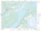
Maps showing Johnsons Brook, Newfoundland and Labrador
Johnsons Brook is a River located in Newfoundland and Labrador and has an elevation of 248 meters.
- Latitude: 49° 8' 5'' North (decimal: 49.1347222)
- Longitude: 57° 20' 53'' West (decimal: -57.3480555)
- Topography Feature Category: River
- Geographical Feature: Brook
- Canadian Province/Territory: Newfoundland and Labrador
- Elevation: 248 meters
- Atlas of Canada Locator Map: Johnsons Brook
- GPS Coordinate Locator Map: Johnsons Brook Lat/Long
Johnsons Brook NTS Map Sheets