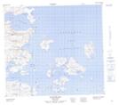
Maps showing Jonathon Island, Newfoundland and Labrador
Jonathon Island is a Island located in Newfoundland and Labrador and has an elevation of 41 meters.
- Latitude: 56° 50' 31'' North (decimal: 56.8418294)
- Longitude: 61° 13' 15'' West (decimal: -61.2208198)
- Topography Feature Category: Island
- Geographical Feature: Island
- Canadian Province/Territory: Newfoundland and Labrador
- Elevation: 41 meters
- Atlas of Canada Locator Map: Jonathon Island
- GPS Coordinate Locator Map: Jonathon Island Lat/Long