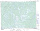
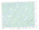
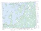
Maps showing Jumper Brook, Newfoundland and Labrador
Jumper Brook is a River located in Newfoundland and Labrador and has an elevation of 28 meters.
- Latitude: 49° 21' 14'' North (decimal: 49.3538888)
- Longitude: 54° 44' 32'' West (decimal: -54.7422222)
- Topography Feature Category: River
- Geographical Feature: Brook
- Canadian Province/Territory: Newfoundland and Labrador
- Elevation: 28 meters
- Atlas of Canada Locator Map: Jumper Brook
- GPS Coordinate Locator Map: Jumper Brook Lat/Long
Jumper Brook NTS Map Sheets