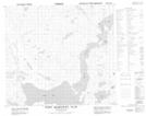
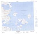
Maps showing Kolotulik Bay, Newfoundland and Labrador
Kolotulik Bay is a Bay located in Newfoundland and Labrador and has an elevation of 63 meters.
- Latitude: 56° 48' 18'' North (decimal: 56.8048765)
- Longitude: 61° 25' 31'' West (decimal: -61.4252588)
- Topography Feature Category: Bay
- Geographical Feature: Bay
- Canadian Province/Territory: Newfoundland and Labrador
- Elevation: 63 meters
- Atlas of Canada Locator Map: Kolotulik Bay
- GPS Coordinate Locator Map: Kolotulik Bay Lat/Long
Kolotulik Bay NTS Map Sheets