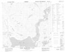
Maps showing Kolotulik Lake, Newfoundland and Labrador
Kolotulik Lake is a Lake located in Newfoundland and Labrador and has an elevation of 49 meters.
- Latitude: 56° 46' 15'' North (decimal: 56.7709489)
- Longitude: 61° 34' 5'' West (decimal: -61.5681166)
- Topography Feature Category: Lake
- Geographical Feature: Lake
- Canadian Province/Territory: Newfoundland and Labrador
- Elevation: 49 meters
- Atlas of Canada Locator Map: Kolotulik Lake
- GPS Coordinate Locator Map: Kolotulik Lake Lat/Long
Kolotulik Lake NTS Map Sheets