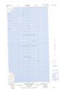
Maps showing Lady Bight Harbour, Newfoundland and Labrador
Lady Bight Harbour is a Bay located in Newfoundland and Labrador.
- Latitude: 57° 27' 5'' North (decimal: 57.4514069)
- Longitude: 61° 32' 22'' West (decimal: -61.5393209)
- Topography Feature Category: Bay
- Geographical Feature: Harbour
- Canadian Province/Territory: Newfoundland and Labrador
- Atlas of Canada Locator Map: Lady Bight Harbour
- GPS Coordinate Locator Map: Lady Bight Harbour Lat/Long