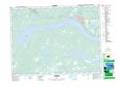
Maps showing Little Dead Wolf Brook, Newfoundland and Labrador
Little Dead Wolf Brook is a River located in Newfoundland and Labrador and has an elevation of 61 meters.
- Latitude: 48° 46' 47'' North (decimal: 48.7797222)
- Longitude: 54° 56' 20'' West (decimal: -54.9388888)
- Topography Feature Category: River
- Geographical Feature: Brook
- Canadian Province/Territory: Newfoundland and Labrador
- Elevation: 61 meters
- Atlas of Canada Locator Map: Little Dead Wolf Brook
- GPS Coordinate Locator Map: Little Dead Wolf Brook Lat/Long