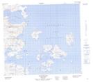
Maps showing Little Fish Island, Newfoundland and Labrador
Little Fish Island is a Island located in Newfoundland and Labrador and has an elevation of 13 meters.
- Latitude: 56° 54' 58'' North (decimal: 56.9160901)
- Longitude: 61° 18' 5'' West (decimal: -61.3013168)
- Topography Feature Category: Island
- Geographical Feature: Island
- Canadian Province/Territory: Newfoundland and Labrador
- Elevation: 13 meters
- Atlas of Canada Locator Map: Little Fish Island
- GPS Coordinate Locator Map: Little Fish Island Lat/Long