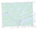
Maps showing Lower Dark Cove, Newfoundland and Labrador
Lower Dark Cove is a Bay located in Newfoundland and Labrador and has an elevation of 0 meters.
- Latitude: 48° 49' 21'' North (decimal: 48.8224999)
- Longitude: 54° 8' 46'' West (decimal: -54.1461111)
- Topography Feature Category: Bay
- Geographical Feature: Cove
- Canadian Province/Territory: Newfoundland and Labrador
- Elevation: 0 meters
- Atlas of Canada Locator Map: Lower Dark Cove
- GPS Coordinate Locator Map: Lower Dark Cove Lat/Long