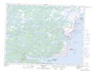
Maps showing Main Pool's Island, Bonavista North, Newfoundland and Labrador
Main Pool's Island is a Island located in Bonavista North, Newfoundland and Labrador and has an elevation of 0 meters.
- Latitude: 49° 6' 37'' North (decimal: 49.1102777)
- Longitude: 53° 35' 33'' West (decimal: -53.5925000)
- Topography Feature Category: Island
- Geographical Feature: Island
- Canadian Province/Territory: Newfoundland and Labrador
- Elevation: 0 meters
- Location: Bonavista North
- Atlas of Canada Locator Map: Main Pool's Island
- GPS Coordinate Locator Map: Main Pool's Island Lat/Long
Main Pool's Island NTS Map Sheets