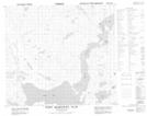
Maps showing Man O'War Brook, Newfoundland and Labrador
Man O'War Brook is a River located in Newfoundland and Labrador and has an elevation of 149 meters.
- Latitude: 56° 58' 8'' North (decimal: 56.9687976)
- Longitude: 61° 32' 30'' West (decimal: -61.5417082)
- Topography Feature Category: River
- Geographical Feature: Brook
- Canadian Province/Territory: Newfoundland and Labrador
- Elevation: 149 meters
- Atlas of Canada Locator Map: Man O'War Brook
- GPS Coordinate Locator Map: Man O'War Brook Lat/Long
Man O'War Brook NTS Map Sheets