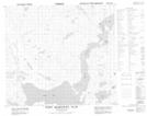
Maps showing Man O'War Peak, Newfoundland and Labrador
Man O'War Peak is a Mountain located in Newfoundland and Labrador and has an elevation of 884 meters.
- Latitude: 56° 58' 7'' North (decimal: 56.9686144)
- Longitude: 61° 40' 17'' West (decimal: -61.6712728)
- Topography Feature Category: Mountain
- Geographical Feature: Peak
- Canadian Province/Territory: Newfoundland and Labrador
- Elevation: 884 meters
- Atlas of Canada Locator Map: Man O'War Peak
- GPS Coordinate Locator Map: Man O'War Peak Lat/Long
Man O'War Peak NTS Map Sheets