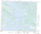
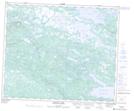
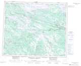
Maps showing McKay River, Menihek, Newfoundland and Labrador
McKay River is a River located in Menihek, Newfoundland and Labrador and has an elevation of 479 meters.
- Latitude: 53° 42' 22'' North (decimal: 53.7061975)
- Longitude: 65° 24' 10'' West (decimal: -65.4028556)
- Topography Feature Category: River
- Geographical Feature: River
- Canadian Province/Territory: Newfoundland and Labrador
- Elevation: 479 meters
- Location: Menihek
- Atlas of Canada Locator Map: McKay River
- GPS Coordinate Locator Map: McKay River Lat/Long
McKay River NTS Map Sheets