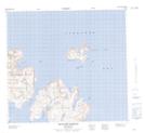
Maps showing Mugford Harbour, Newfoundland and Labrador
Mugford Harbour is a Bay located in Newfoundland and Labrador and has an elevation of 100 meters.
- Latitude: 57° 47' 36'' North (decimal: 57.7933253)
- Longitude: 61° 42' 59'' West (decimal: -61.7162806)
- Topography Feature Category: Bay
- Geographical Feature: Harbour
- Canadian Province/Territory: Newfoundland and Labrador
- Elevation: 100 meters
- Atlas of Canada Locator Map: Mugford Harbour
- GPS Coordinate Locator Map: Mugford Harbour Lat/Long
Mugford Harbour NTS Map Sheets