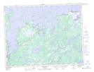
Maps showing Musgrave Harbour, Fogo, Newfoundland and Labrador
Musgrave Harbour is a Town located in Fogo, Newfoundland and Labrador and has an elevation of 11 meters.
- Latitude: 49° 25' 0'' North (decimal: 49.4167027)
- Longitude: 53° 57' 52'' West (decimal: -53.9644222)
- Topography Feature Category: Town
- Geographical Feature: Town
- Canadian Province/Territory: Newfoundland and Labrador
- Elevation: 11 meters
- Location: Fogo
- Atlas of Canada Locator Map: Musgrave Harbour
- GPS Coordinate Locator Map: Musgrave Harbour Lat/Long
Musgrave Harbour NTS Map Sheets