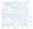
Maps showing Nain, Torngat Mountains, Newfoundland and Labrador
Nain is a Village located in Torngat Mountains, Newfoundland and Labrador and has an elevation of 33 meters.
- Latitude: 56° 32' 11'' North (decimal: 56.5363193)
- Longitude: 61° 43' 8'' West (decimal: -61.7189416)
- Topography Feature Category: Village
- Geographical Feature: Community
- Canadian Province/Territory: Newfoundland and Labrador
- Elevation: 33 meters
- Location: Torngat Mountains
- Atlas of Canada Locator Map: Nain
- GPS Coordinate Locator Map: Nain Lat/Long