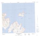
Maps showing Nanuktut Islands, Newfoundland and Labrador
Nanuktut Islands is a Island located in Newfoundland and Labrador and has an elevation of 1 meters.
- Latitude: 57° 53' 36'' North (decimal: 57.8933172)
- Longitude: 61° 42' 21'' West (decimal: -61.7059296)
- Topography Feature Category: Island
- Geographical Feature: Islands
- Canadian Province/Territory: Newfoundland and Labrador
- Elevation: 1 meters
- Atlas of Canada Locator Map: Nanuktut Islands
- GPS Coordinate Locator Map: Nanuktut Islands Lat/Long
Nanuktut Islands NTS Map Sheets