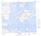
Maps showing Natsutuk Island, Newfoundland and Labrador
Natsutuk Island is a Island located in Newfoundland and Labrador and has an elevation of 58 meters.
- Latitude: 56° 39' 37'' North (decimal: 56.6602377)
- Longitude: 61° 2' 52'' West (decimal: -61.0478741)
- Topography Feature Category: Island
- Geographical Feature: Island
- Canadian Province/Territory: Newfoundland and Labrador
- Elevation: 58 meters
- Atlas of Canada Locator Map: Natsutuk Island
- GPS Coordinate Locator Map: Natsutuk Island Lat/Long