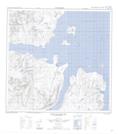
Maps showing Nehungateluk Peninsula, Newfoundland and Labrador
Nehungateluk Peninsula is a Cape located in Newfoundland and Labrador.
- Latitude: 59° 22' 29'' North (decimal: 59.3746333)
- Longitude: 63° 46' 7'' West (decimal: -63.7686090)
- Topography Feature Category: Cape
- Geographical Feature: Peninsula
- Canadian Province/Territory: Newfoundland and Labrador
- Atlas of Canada Locator Map: Nehungateluk Peninsula
- GPS Coordinate Locator Map: Nehungateluk Peninsula Lat/Long
Nehungateluk Peninsula NTS Map Sheets