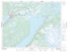
Maps showing Nicholsville, Humber Valley, Newfoundland and Labrador
Nicholsville is a Unincorporated area located in Humber Valley, Newfoundland and Labrador and has an elevation of 23 meters.
- Latitude: 49° 11' 26'' North (decimal: 49.1905555)
- Longitude: 57° 27' 15'' West (decimal: -57.4541666)
- Topography Feature Category: Unincorporated area
- Geographical Feature: Neighbourhood
- Canadian Province/Territory: Newfoundland and Labrador
- Elevation: 23 meters
- Location: Humber Valley
- Atlas of Canada Locator Map: Nicholsville
- GPS Coordinate Locator Map: Nicholsville Lat/Long
Nicholsville NTS Map Sheets