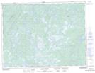
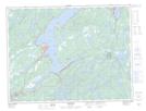
Maps showing Norris Arm, Lewisporte, Newfoundland and Labrador
Norris Arm is a Town located in Lewisporte, Newfoundland and Labrador and has an elevation of 31 meters.
- Latitude: 49° 4' 38'' North (decimal: 49.0773444)
- Longitude: 55° 14' 16'' West (decimal: -55.2379027)
- Topography Feature Category: Town
- Geographical Feature: Town
- Canadian Province/Territory: Newfoundland and Labrador
- Elevation: 31 meters
- Location: Lewisporte
- Atlas of Canada Locator Map: Norris Arm
- GPS Coordinate Locator Map: Norris Arm Lat/Long
Norris Arm NTS Map Sheets