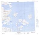
Maps showing Orton Island, Newfoundland and Labrador
Orton Island is a Island located in Newfoundland and Labrador and has an elevation of 148 meters.
- Latitude: 56° 52' 13'' North (decimal: 56.8703509)
- Longitude: 61° 4' 16'' West (decimal: -61.0710895)
- Topography Feature Category: Island
- Geographical Feature: Island
- Canadian Province/Territory: Newfoundland and Labrador
- Elevation: 148 meters
- Atlas of Canada Locator Map: Orton Island
- GPS Coordinate Locator Map: Orton Island Lat/Long