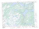
Maps showing Otter Pond, Newfoundland and Labrador
Otter Pond is a Lake located in Newfoundland and Labrador.
- Latitude: 48° 16' 35'' North (decimal: 48.2763888)
- Longitude: 54° 13' 52'' West (decimal: -54.2311111)
- Topography Feature Category: Lake
- Geographical Feature: Pond
- Canadian Province/Territory: Newfoundland and Labrador
- GPS Coordinate Locator Map: Otter Pond Lat/Long
Otter Pond NTS Map Sheets